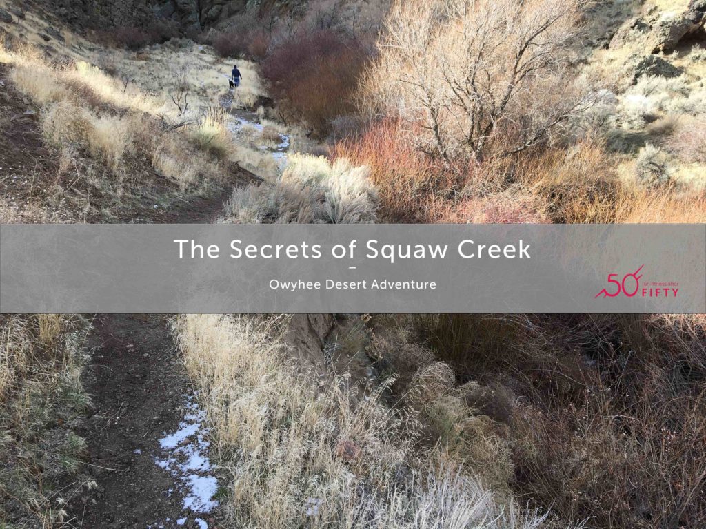
Should we talk about the bull first or the bouldering?
The deep muscle aches from the virus were almost gone. The hacking cough was still painful, but I felt like I needed to move and get some fresh air. So, when dear hubby wondered if I was up for a walk, I said, “Yes, please.”
I don’t know why I thought he meant a walk around our new neighborhood. When he said he wanted to explore a new place in the Owyhee Desert, I almost backed out. Instead, I emphasized that I wasn’t sure I could go far. He was agreeable to dealing with my limits.
And so began our adventure that included huge bulls, disintegrating precipitous trails, climbing huge boulders, and a beautiful canyon.
Where is the Owyhee Desert?
(If you don’t care where it is, skip to the video below!)
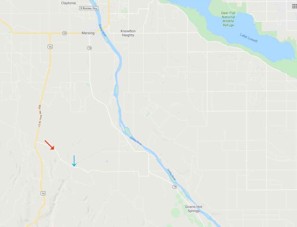
The Owyhee covers covers 9 million acres in Idaho, Oregon, and Nevada, according to Idaho Fish and Game. We live in Marsing, which is considered a perimeter town to the otherwise desolate space. If you want more maps of trails and points of interest in the Owyhee Desert, check out this pdf published by the BLM.
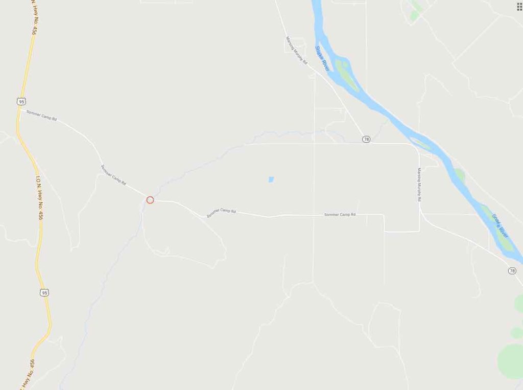
However, Squaw Creek isn’t on any of those maps. I searched high and low for a map specifically of Squaw Creek and couldn’t find one, so below are some screen shots to help.
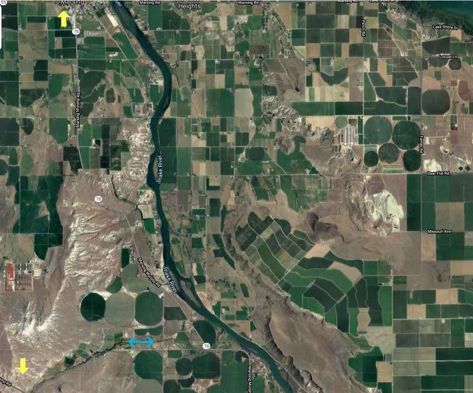
The yellow arrow at the bottom left points to where Squaw Creek intersects with Summercamp Road (which I will show more closely in another photo below).
The blue arrow near the bottom shows approximately where Squaw Creek is and where it empties into the Snake River.
(screen shot compliments of Google maps)
(screen shot compliments of Google maps)
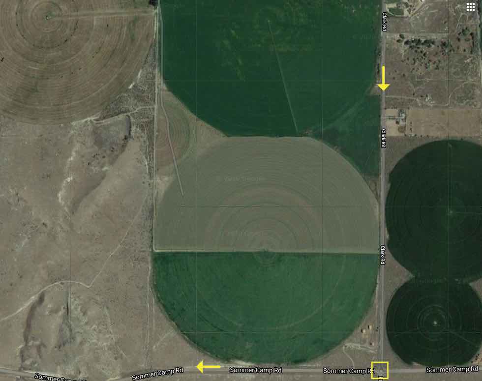
The blue arrow shows where Squaw Creek is from there.
(screen shot compliments of Google maps)
(screen shot compliments of Google maps)
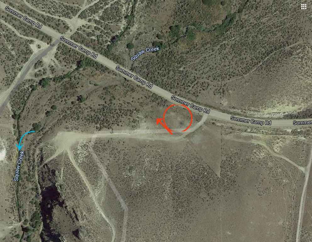
(screen shot compliments of Google maps)
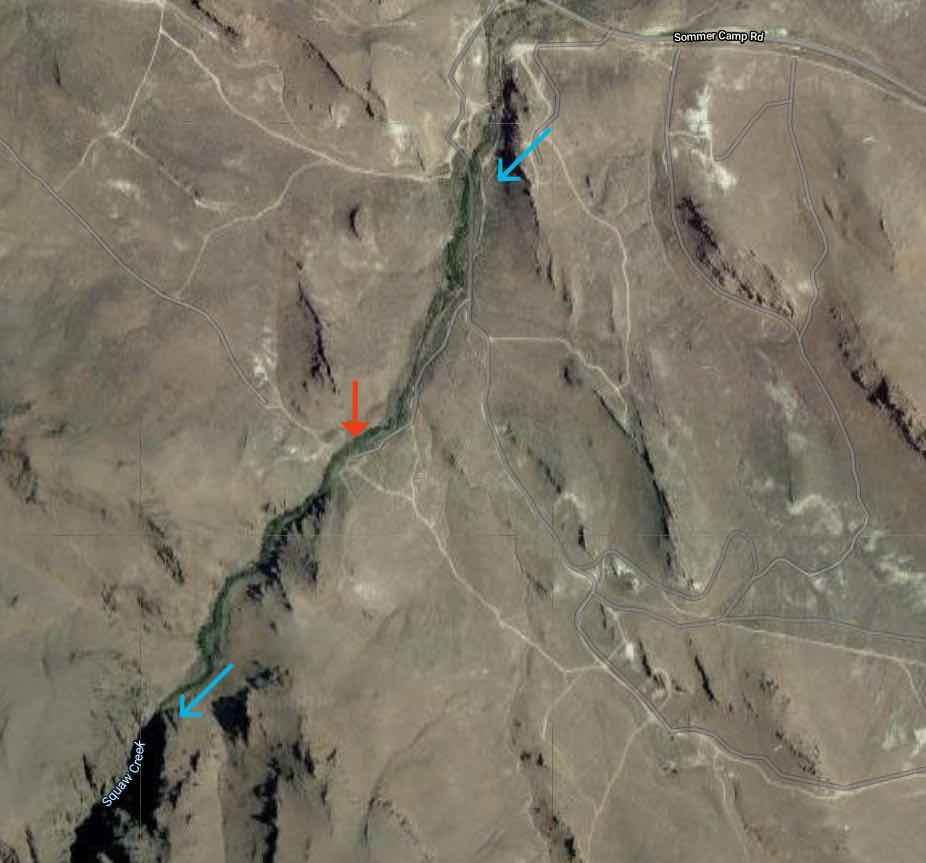
The red arrow show about where anything like a road ends.
The lower blue arrow shows where the canyon starts in earnest.
(screen shot compliments of Google maps)
Did someone say something about a bull?
I know about cattle out on BLM land. I’ve hiked a lot of places out there. I’ve been surrounded by a pack of dogs and I know there are coyotes and rattle snakes. I still wasn’t expecting the huge bull right in our path as we rounded a corner.
I will admit to being panicked. He looked straight at us like we look at an ant right before we squish it. I backed up on the trail, but dear husband tried some arm waving to get the bull to move. The bull did not want to move.
Our dog, Boo, dashed around, not actually at the bull, but because she is an energetic black lab who always dashes around on hikes. She seemed fairly oblivious to the bull and I wondered if he’d casually flick her with his horns.
Instead, he decided we weren’t worth the trouble and plodded a bit further into the sage brush, still keeping his eye on Boo. He looked like he could easily charge at a moment’s notice. Dear hubby told me to move up the path while the bull was watching Boo… and I did.
Should you take a picture of a wild bull?
In spite of my terror, I was interested in a photo. Maybe because it makes my fear seem more worth it? But I couldn’t bring myself to stop for a photo this time.
When he was still there on the way back, I took a photo from way back, but it ended up being like taking photos of whales in Hawaii. They never look as big or as close in the photo as they do in person. Even my husband said this bull had some big equipment!
Where did the path go?
The road narrowed down to what I thought was nothing, but dear hubby kept walking. He had studied the map and could see the rocks that he thought were the beginning of the canyon.
After a bit, a narrow trail became a little more obvious. We came across one other lone hiker, who asked us where the bull was now… Other than that, we might as well have been on the moon.
Here is the video:
Below is a movie/slideshow that shows highlights of the hike, everything from the tumbleweed blockade, that necessitated quite a detour, to the intimidating rock formations. I am putting in that photo of the bull, but keep in mind that his surroundings don’t give a good idea of his size when he finally got away from the path. His head was on level with mine and he must have weighed over a ton.
Is it safe to hike Squaw Creek?
How easily do you get lost? Is it flood season? Is the temperature safe for getting warm? These are the kinds of questions you should ask when thinking about hiking along Squaw Creek.
The nearly 3 miles we hiked this particular cold day in January required moderate physical stamina. It wouldn’t be easy to run or ride a mountain bike along the second half of our hike, right up to the canyon opening. Inside the canyon would certainly be a lot of bouldering.
There were places where the trail was washing out along the side of a precipitous edge that dropped off about 30 feet down to the creek. There were other places where the creek had to be crossed amidst thick shrubs and no distinct opening on the other side. Some parts of the trail were liberally strewn with large rocks that would make either running or biking pretty impossible.
A couple of years ago, dear hubby took some of our teenage kids to hike up to the other end of Squaw Creek canyon. They encountered the same issues. They had our 6 year old Australian Shepherd mix dog with them and she could not deal with the boulders. She was carried over some parts, but it was stressful for her.
I would definitely go again. I don’t know about climbing around in the canyon, though. I would need evaluate the likelihood of a flash flood, so probably not at all in the spring.
However, it would be nice to go in the spring to see it when it is green. I like to try identifying wild flowers, too. Maybe I will see you out there?